

Work resumed at full pace In 1874, when the high trestle over the Le Sueur River bridge was built. The line continued through towns such as Mapleton. After going through a couple more towns, it ended up at the Milwaukee Road at Wells. It could access Albert Lea, Austin and other places too. It eventually did become part of the Milwaukee Road in 1880.
After the Milwaukee Road takeover, it was reduced to a branch line. It did connect to the line from Mankato to Farmington. Milwaukee Road operated over this line for almost 100 year s, before it finally abandoned a portion from Minnesota Lake, near wells to Mankato. The part from Wells to Minnesota Lake is still used.
The tracks were ripped out, but for some reason, the bridges never were. Soon after the
abandonment, a group of citizens proposed the development of a trail from Mankato to
Rapidan, just south of Mankato.
But controversy followed. Proponents cited the scenic valley, preservation of the historic
high trestle, danger to bikers and pedestrians along TH66, and conservation values.
Opponents cited danger to users, loss of farmland, and loss of privacy to adjacent
landowners. Local newspapers got in on the debate, and opponents began a petition to put
an end to trail talks. Both the county and the DNR lost interest in the project.
But people weren�t ready to give up. A private group within the city purchased the center
30 feet of the railroad for a couple miles. A trail was developed from West High School
to the south end of town.
By 1991, the Red Jacket Trail Task Force which was organized by a group of citizens
approaches Blue Earth County and asked for money and permission to develop all the way to
Rapidan. 24 land owners agreed. About 1/3 gave up the land, another 1/3 sold it, and the
last bit the county had to just take their land.
Finally, the trail was built by the task force. They almost instantly turned it over to
the County. This trail is a rare example of the county, state, city and citizens all
working together.
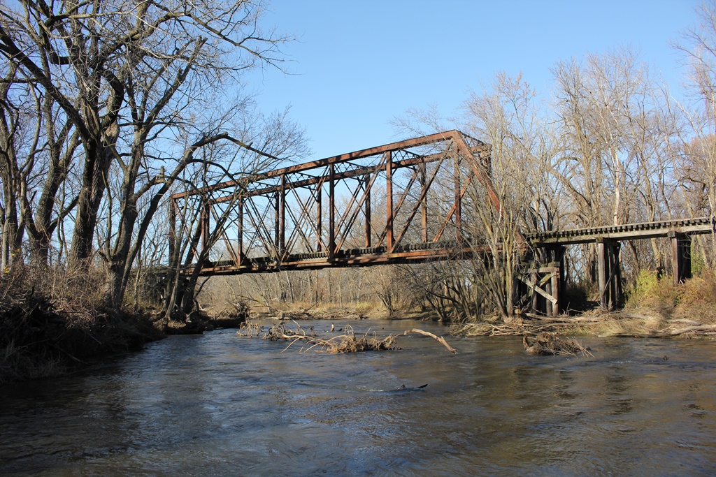
This trail starts in suburban backyards, goes up into the bluffs, crosses high above the
Le Sueur River, then goes into the woods and eventually crosses through farm fields.
Disaster struck the Le Sueur River bridge, nicknamed the Red Jacket Trestle in fall 2010
after record flooding. Part of the stone base on Pier #3 collapsed, and there was debate
over what to do with the bridge. It was decided to pull Span #2 off the pier, and repair
it. But when the span came off, the pier collapsed. The span was put on the ground in
Red Jacket Park, next to the bridge. A replica pier was built out of concrete, the span
was put back in place, and it reopened in November 2011.
12/03/21
This large and unique bridge crosses the Maple River just south of Good Thunder, and has been preserved by a very generous landowner!
The bridge here was built in approximately 1930, to replace an 1882 truss which was relocated from the first bridge at Byron, Illinois in approximately 1905.
This span is believed to have been part of the second Byron Bridge, which existed from 1897 until 1929. Because of the large skew of that span, the Milwaukee Road reused older spans across the system to replace other skewed wooden bridges.
Despite its abandoned state, the bridge is well maintained for hunting and walking by the landowner. The landowner had mentioned interest of rehabilitating and restoring the bridge. For a unique and beautiful structure, this is absolutely worth it!
In a technical sense, the bridge is also an uncommon design. The bridge contains a 45 degree skew, and an 8-Panel Pratt Through Truss with pinned connections. This truss contains a single vertical endpost on each end, adding to the unique design. It appears that one panel was removed, giving a total span length of 139 feet 6 inches.
The approaches are constructed of wood, as are the piers. Overall, it appears to be in very good condition for the age.
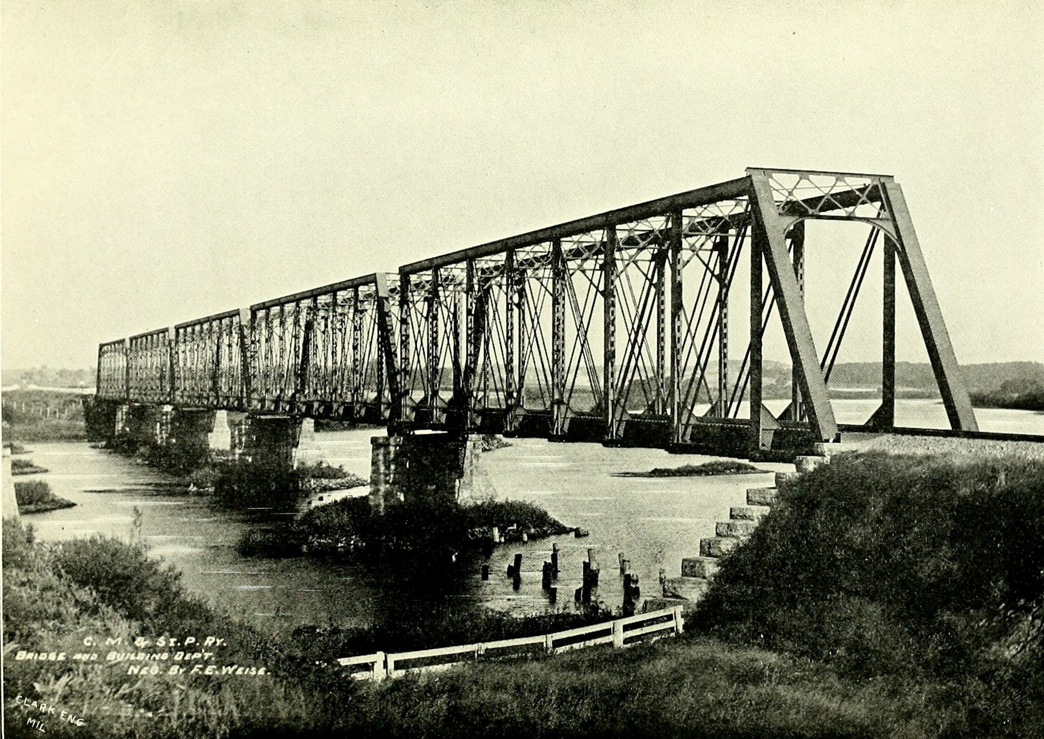
Byron, Illinois bridge; This bridge was one of the five spans shown. Note the vertical endpost of the three middle spans.
The author has ranked this bridge regionally significant on a number of factors. The bridge retains an excellent and exceptional level of historic integrity. Preservation of this structure also adds to the significance, as well as the unique design.
The photo above is an overview. This structure was accessed with permission.